Posts

Boston Logan Airport: Winthrop
Image
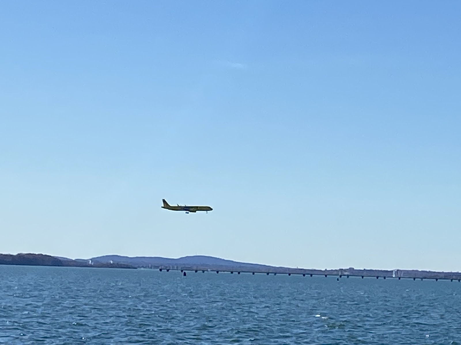
  Boston’s Logan airport (KBOS) faces the Boston Harbor. As a result, there are a number of locations surrounding the bay that offers great views of planes taking off and landing. A few notable locations from the NYC Aviation blog ( https://www.nycaviation.com/spotting-guides/bos ) are included for reference.   Constitution Beach:  https://maps.app.goo.gl/eRdGNRXyNwdJFBiq8 Coughlin Park:  https://maps.app.goo.gl/aThV4UM9K75VQ4nt6 , Yirrel Beach:  https://maps.app.goo.gl/dEaqpuGybHVp5DWz5 Pleasure Bay:  https://maps.app.goo.gl/yuZehuDA6HijjoDe7 Airport Subway East Boston Park:  https://maps.app.goo.gl/Ha5FLDeuqhsDBJPz8 Rt 145 Saratoga Road Main St Winthrop:  https://maps.app.goo.gl/yfsP6BpQr9YNnhW79   The Route 145 location in Winthop offers great views of both runways for watching planes land and take off. There is street parking available, keeping in mind that this is a residential area. Arriving earlier will allow for f...

New England Air Museum

Image
  New England Air Museum https://maps.app.goo.gl/Whwdc9RbxMirQndf6 http://www.neam.org/   The New England Air Museum is located in the vicinity of the Hartford-Springfield Airport (KBDL) in Windsor Locks at 36 Perimeter Rd, Windsor Locks, CT 06096. The museum itself has a number of historical military and civilian passenger aircraft on display. As the museum is adjacent to the airport, planes can be seen taking off from the south end of the parking lot that follows Perimeter Road. The parking lot offers ample parking for museum visitors.

Ike Jones Road at Airway Avenue and Lyon Air Museum

Image
Ike Jones Road at Airway Avenue and Lyon Air Museum Google Maps mobile link: https://maps.app.goo.gl/wPUxpdcQEWXU1kwP8?g_st=ic Google Maps web link: https://www.google.com/maps/@33.6749822,-117.8724357,18.55z   Directly next to the airport is a side street with street parking which dead-ends into the Lyon Air Museum. The nearest intersection is Ike Jones Road at Airway Avenue, located off Baker Street near Red Hill Avenue. Located directly adjacent to the airport, clear view of parked private airplanes as well as the active runway where airplanes are taking off. Furthermore, the Lyon Air Museum offers an additional educational resource for visitors.   According to their brochure (picked up in March of 2023, ©2022), the Lyon Air Museum (link: https://lyonairmuseum.org/ ) is an “exhibit comprised of authentic aircraft, rare vehicles and related memorabilia with emphasis on the defining even of the 20 th century – World War II. Through captivating and though provokin...

Flight at Tustin Legacy

Image
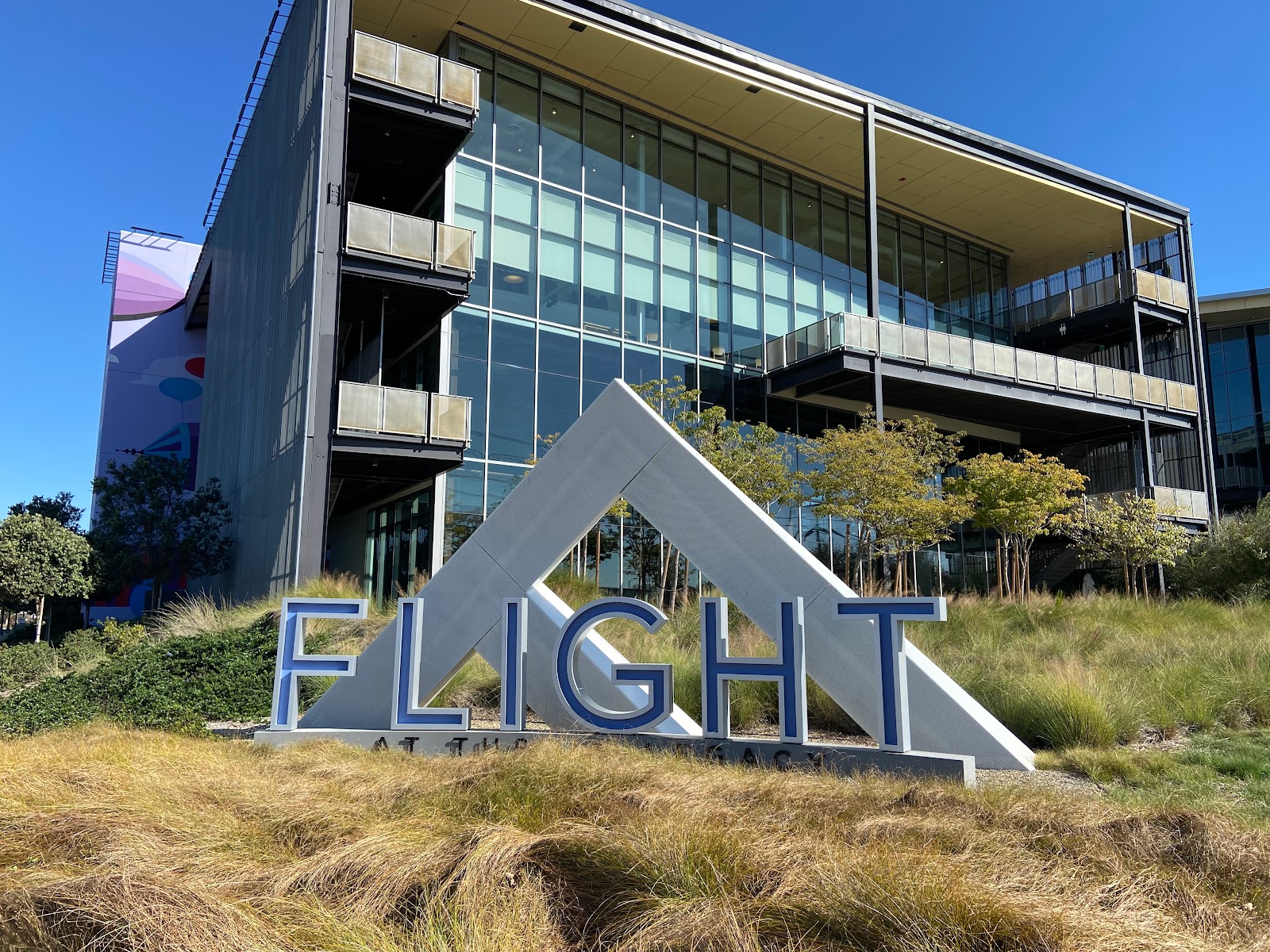
z Flight at Tustin Legacy: http://flight-tustin.com/ Google Maps mobile link: https://maps.app.goo.gl/SMbx26atPfruT8qm8?g_st=ic Google Maps web link: https://www.google.com/maps/place/Tustin+Legacy+Park/@33.7056515,-117.844186,17z/data=!4m5!3m4!1s0x80dcdfa0bd1bda9d:0xe9a7fc06dac8eb40!8m2!3d33.7056513!4d-117.84204   Located at the northeast intersection of Barranca Parkway at Red Hill Avenue, Flight at Tustin Legacy is a mixed-use office park, food court, and paved paths for pedestrians.   From this location on typical direction days, airplanes can be seen landing facing westbound.   Pros: Abundant parking Convenient location Public restrooms Pet-friendly and family-friendly \ Plenty of both indoor and outdoor seating at the food court Cons: Food court closed on Sundays and closes early on Mondays Limited shelter from rain, albeit Southern California hardly sees any inclement weather  

John Wayne Airport Cell Phone Waiting Lot

Image
Google Maps mobile link: https://maps.app.goo.gl/DwgiGkdC2TS4m9AP6?g_st=ic Google Maps web link: https://www.google.com/maps/place/John+Wayne+Airport+Cell+Phone+Waiting+Lot/@33.6719619,-117.8673269,17z/data=!3m1!4b1!4m5!3m4!1s0x80dcdef73fe9d94b:0xcf2bd0e02608cee3!8m2!3d33.6719575!4d-117.864752   The cell phone waiting lot can be found at the intersection of Campus Drive at Macarthur Boulevard. This lot is accessible by taking the Bristol Street exit from both the northbound and southbound directions of SR-73, then turning left onto Campus Drive, heading northbound to the intersection at Macarthur Boulevard.   There is abundant parking at this cell phone lot, although I generally do not recommend leaving the vehicle for long periods of time. Airplanes can be seen taxiing behind the palm trees and parked planes.   Pros: Abundant parking Convenient location Cons: No public restrooms

Back Bay, Newport Beach, Upper Newport Bay Nature Preserve, Peter and Mary Muth Interpretive Center

Image
Back Bay, Newport Beach, Upper Newport Bay Nature Preserve, Peter and Mary Muth Interpretive Center (parking): Google Maps mobile link: https://maps.app.goo.gl/NYBcTJGfPAwmEn1v6?g_st=ic Google Maps web link: https://www.google.com/maps/place/Peter+and+Mary+Muth+Interpretive+Center+(main+entrance)/@33.652227,-117.8939447,15.43z/data=!4m5!3m4!1s0x80dcdfafb4d544c7:0xe9ffb96e417cc0a5!8m2!3d33.6533137!4d-117.8853208 Driving to this location, take SR-55 and take the Newport Boulevard exit from both the northbound and southbound directions, or take SR-73 and take the Bristol Street exit from both the northbound and southbound directions. Head east on University Drive or south on Irvine Avenue, and the parking lot is located near the southeast corner of University Drive at Irvine Avenue. There is a lot with parking, and is located near the Back Bay Center. From this location on typical direction days, airplanes can be seen taking off from the northeast to southwest direction. Pros: Convenient ...

Back Bay, Newport Beach, Eastbluff Drive, Vista Point

Image
Google Maps mobile link: https://maps.app.goo.gl/RRF4SpaTq9jneTDY8?g_st=ic Google Maps web link: https://www.google.com/maps/place/Vista+Point/@33.6464056,-117.8755885,16.26z/data=!4m5!3m4!1s0x80dcde3616f58aef:0x303b4ef4fa2e3784!8m2!3d33.6452062!4d-117.870803   Driving to this particular location, take SR-73 and take the University Drive exit from both the northbound and southbound directions. Limited street parking can be found by turning left on Jamboree Road heading southbound, then turning right on Eastbluff Drive. Parking can be found along the street.   From this location on typical direction days, airplanes can be seen taking off from the northeast to southwest direction.   Pros: Convenient location Scenic setting with paved and unpaved paths for walking, running, cycling, hiking, and other outdoor activities Pet friendly Cons: Limited parking available, need to go early No public restrooms Limited seating available ...

Back Bay, Newport Beach, northeast

Image
Google Maps mobile link: https://maps.app.goo.gl/t77kFV2JNhb4pS8p6?g_st=ic Google Maps web link: https://www.google.com/maps/@33.6526534,-117.8720577,17.36z   Driving to this particular location, take SR-73 and take the University Drive exit from both the northbound and southbound directions. Limited street parking can be found by turning right on Jamboree Road heading northbound, then turning left on Bayview Way. There is a Cul-de-sac at the end of Bayview Road. Parking can be found along the street.   From this location on typical direction days, airplanes can be seen taking off from the northeast to southwest direction.   Pros: Convenient location Scenic setting with paved and unpaved paths for walking, running, cycling, hiking, and other outdoor activities Pet friendly Cons: Limited parking available, need to go early No public restrooms Limited seating available

Back Bay Center

Image
Back Bay Center: Google Maps mobile link: https://maps.app.goo.gl/jDJ44GUTx5srN7pP7?g_st=ic Google Maps web link: https://www.google.com/maps/place/Back+Bay+Center/@33.6595914,-117.8872467,15.71z/data=!4m5!3m4!1s0x80dcdfa9454c7def:0x41409d8f1a6bcce6!8m2!3d33.658114!4d-117.885539   The Back Bay Center is a multi-use primarily retail center located at 2651-2675 Irvine Ave, Costa Mesa, CA 92627. This strip mall style shopping center is easily accessible from SR-55 by exiting at Newport Boulevard from both the northbound and southbound directions, and from SR-73 (toll road) by exiting at Bristol Street from both the northbound and southbound directions. There is abundant parking particularly early in the morning, in the evenings and on weekends. From this location on typical direction days, airplanes can be seen taking off from the northeast to southwest direction.   There are nearby restaurants and cafes to grab a snack, meal or a drink while watching airplanes. M...

Airport Business Center

Image
 Airport Business Center: Google Maps mobile link: https://maps.app.goo.gl/BApuvz1VrSPv6oz38?g_st=ic Google Maps web link: https://www.google.com/maps/place/Airport+Business+Center/@33.6893328,-117.8593206,14.69z/data=!4m5!3m4!1s0x80dcdec216434a1d:0x1088a21f5f36d7c!8m2!3d33.6895134!4d-117.854009   The Airport Business Center is a 1,168,237 square foot multi-tenant use business park located in Irvine, California with the primary address being located at the address of 17755 Sky Park Circle, Irvine, CA 92614. Sky Park Circle is a ring road that loops around with three outlets to Red Hill Avenue, Macarthur Boulevard, and Main Street. It is easily accessible from the local freeways of I-405 by exiting at Macarthur Boulevard from both northbound and southbound directions, and SR-55 also by exiting at Macarthur Boulevard from both northbound and southbound directions.   This business park is conveniently located just two miles from John Wayne Santa Ana airport. Ther...

Southern California Airplane Spotting

Image
I will be sharing airport and commercial airline public viewing areas. I will start with where I currently reside in Southern California, among other areas that I have lived. I hope to be able to cover other areas in the future. As a start, Southern California has a number of airports serving the greater regional area: Los Angeles International Airport: LAX (IATA) / KLAX (ICAO) John Wayne Airport: SNA (IATA) / KSNA (ICAO) Long Beach Airport: LGB (IATA) / KLGB (ICAO) Ontario International Airport: ONT (IATA) / KONT (ICAO) San Diego International Airport: SAN (IATA) / KSAN (ICAO) There are also a number of regional/municipal and private airports which will not be covered. Throughout the next several articles, I will cover one by one the areas for which to view commercial airplanes taking off and/or landing. I will primarily be focusing on the airports I am most familiar with, specifically Los Angeles International Airport (LAX/KLAX) and John Wayne Airport (SNA/KSNA). ...

Welcome to Beefy Potato's Airplane Spotting blog!

Image
Hello, and welcome to my personal blog! Here I will share all things transportation-related, specifically with viewing #planes and #trains. I will be sharing videos on my YouTube channel  as well as on my social media platforms. I look forward to meeting all of you here! Jennifer Chen The Beefy Potato 585-310-2885   |   thebeefypotato@gmail.com thebeefypotato.blogspot.com/ Create your own  email signature